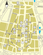
Košice
 |
 |
Being the economic and cultural centre of eastern Slovakia, Košice is the seat of the Košice Region and Košice Self-governing Region, and is home to the Slovak Constitutional Court, three universities, various dioceses, and many museums, galleries, and theatres. In 2013 Košice was the European Capital of Culture, together with Marseille, France. Košice is an important industrial centre of Slovakia, and the U.S. Steel Košice steel mill is the largest employer in the city. The town has extensive railway connections and an international airport.
The city has a preserved historical centre which is the largest among Slovak towns. There are heritage protected buildings in Gothic, Renaissance, Baroque, and Art Nouveau styles with Slovakia's largest church: the Cathedral of St. Elizabeth. The long main street, rimmed with aristocratic palaces, Catholic churches, and townsfolk's houses, is a thriving pedestrian zone with boutiques, cafés, and restaurants. The city is known as the first settlement in Europe to be granted its own coat-of-arms.
The first written mention of the city was in 1230 as "Villa Cassa". The name probably comes from the Slavic personal name Koš, Koša → Košici (Koš'people) → Košice (1382–1383) with the patronymic Slavic suffix "-ice" through a natural development in Slovak (similar place names are also known from other Slavic countries). In Hungarian Koša → Kasa, Kassa with a vowel mutation typical for the borrowing of old Slavic names in the region (Vojkovce → Vajkócz, Sokoľ → Szakalya, Szakál, Hodkovce → Hatkóc, etc.). The Latinized form Cassovia became common in the 15th century.
Another theory is a derivation from Old Slovak kosa, "clearing", related to modern Slovak kosiť, "to reap". Though according to other sources the city name may derive from an old Hungarian the first name which begins with "Ko".
Historically, the city has been known as Kaschau in German, Kassa in Hungarian, Kaşa in Turkish, Cassovia in Latin, Cassovie in French, Cașovia in Romanian, Кошице (Košice) in Russian, Ukrainian and Rusyn, Koszyce in Polish and קאשוי Kashoy in Yiddish (see here for more names). Below is a chronology of the various names:
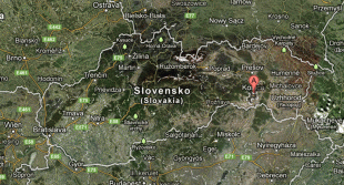
Map - Košice
Map
Country - Slovakia
 |
 |
| Flag of Slovakia | |
The Slavs arrived in the territory of present-day Slovakia in the fifth and sixth centuries. In the seventh century, they played a significant role in the creation of Samo's Empire. In the ninth century, they established the Principality of Nitra, which was later conquered by the Principality of Moravia to establish Great Moravia. In the 10th century, after the dissolution of Great Moravia, the territory was integrated into the Principality of Hungary, which then became the Kingdom of Hungary in 1000. In 1241 and 1242, after the Mongol invasion of Europe, much of the territory was destroyed. The area was recovered largely thanks to Béla IV of Hungary, who also settled Germans, leading them to become an important ethnic group in the area, especially in what are today parts of central and eastern Slovakia.
Currency / Language
| ISO | Currency | Symbol | Significant figures |
|---|---|---|---|
| EUR | Euro | € | 2 |
| ISO | Language |
|---|---|
| HU | Hungarian language |
| SK | Slovak language |


